Scotland: Inverness

Part Two: Inverness

The train ride to Inverness was absolutely gorgeous. With wonderful views of the central highlands and Cairngorms National Park, the three and a half hours passed by quickly.

When we arrived at Inverness, we changed trains to get to the Inverness airport stop, where our hotel was located. With limited time in the afternoon, we decided to go out to Elgin and Forrest, just east of Inverness, to check out a super old cathedral in Elgin, and dinner and distillery in Forres.

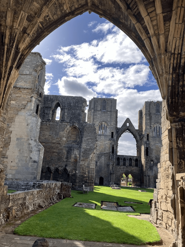
The Elgin Cathedral was super neat (you guessed it – also covered by the Explorer’s Pass, see Edinburgh), but for folks limited to trains and walking, I probably wouldn’t recommend it. It was quite the hike from the train stop, and there wasn’t much else to do within walking distance. If you’re driving by the area en route to the highlands, however, it’s worth the stop.

Forres was a super cute town, though. We had dinner at Mosset Tavern, which was delicious. We shared a cullen sink (creamy fish chowder) and a smoked fish. The walk from the restaurant to the train station was partially along a creak and through a park, which was nice, and there are other strolls in the area that we were interested in, but ran out of time for. Sadly, we also ran out of time for the distillery (Benromach). Next time!

Our train home was cancelled, and unable to find a taxi, we had to wait at the station for an hour for the next train. Definitely a bummer, as we hoped for an early night to start our next day bright and early. By the time the next train arrived, we were the only two aboard. The conductor chatted with us for a bit, with the thickest Scottish accent we’d encountered yet, but he was very chatty and friendly, momentarily easing our frustrations with the travel issues.

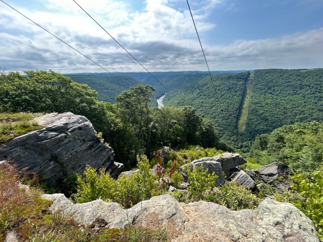
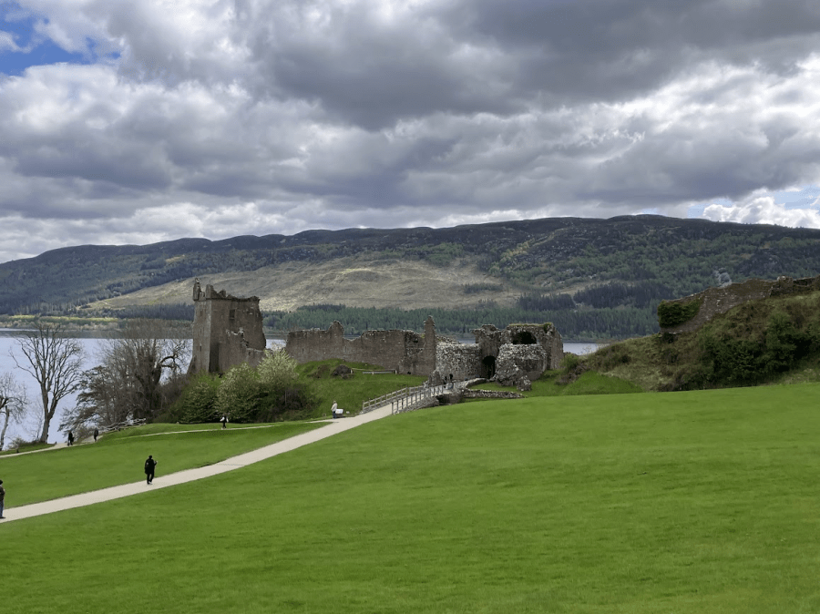
On Wednesday morning, we took the train over to Inverness to catch the bus to Loch Ness and Urquhart Castle. We had originally planned to rent a car, and we’re glad we decided not to; the Ember bus was only £2! It’s a nice coach bus, not a city bus, and very comfortable for the 35-minute ride. The ride feature gorgeous views along Loch Ness; definitely snag a lake-side seat if you can!

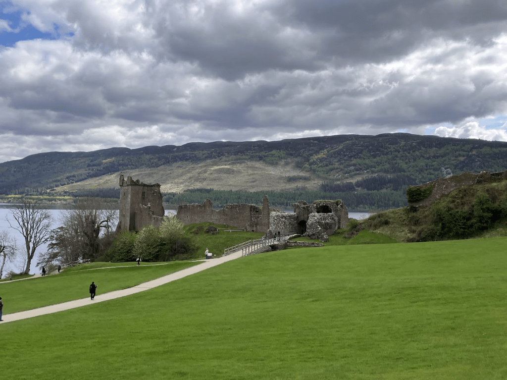
The bus dropped us off at the car park of the Urquhart Castle – convenient, since folks who drive must book parking in advance, the lot was already full – and we walked down to the castle for free entry with our Explorer’s Pass.

The history of this castle was incredibly interesting: they don’t have record of who lived there in its earliest times, but from year 1200 and on, the castle switched hands between the Scots and English several times (and before that, Picts and perhaps Vikings?). During an uprising when the fort was in English hands, shortly after being under siege, the English deliberately blew it up, sending the message that, If we can’t have it, we definitely don’t want the Scots to have it!

The castle has multiple levels to explore with gorgeous views of Loch Ness from every angle (no Nessie sightings, sadly). The one thing to keep in mind if opting into the bus is that it only runs about every hour. While convenient to have that reliable transport, we just had to be pretty strategic with our timing. For example, I think the perfect amount of time for the castle would have a been a bit over an hour to 90 minutes, but we had either 55 minutes, or a bit over 2 hours. Big difference!

After the castle, we booked an Ember bus back to Drumnadrochit for lunch (Fiddlers Highland Restaurant, good but pricey), and then back to Inverness to explore the town for the afternoon.

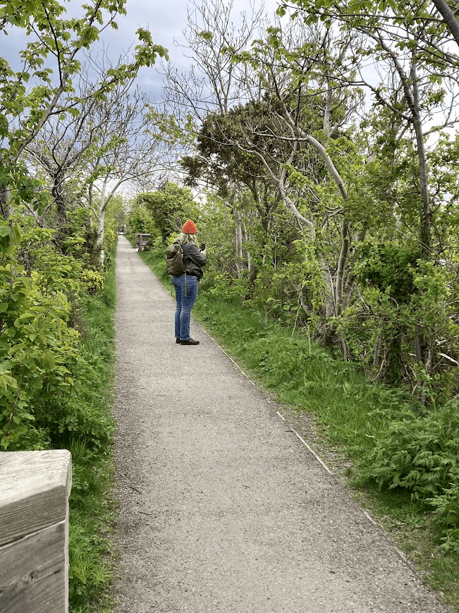
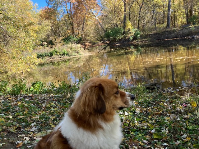
The stroll along River Ness was really lovely, enjoying the parks, gardens, water and architecture during our walk. After a bit under a mile, we reached the Ness Islands, a small island park in the midst of the river. On the other side is the botanical gardens (closed by that point) which we walked along on the way back to the city center.

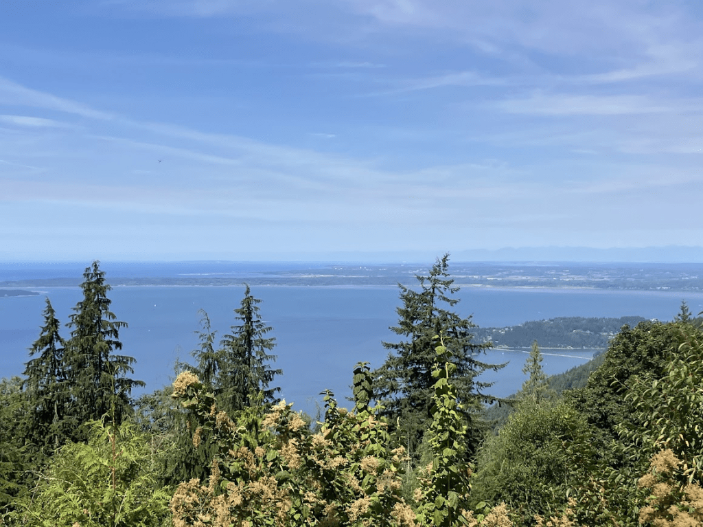
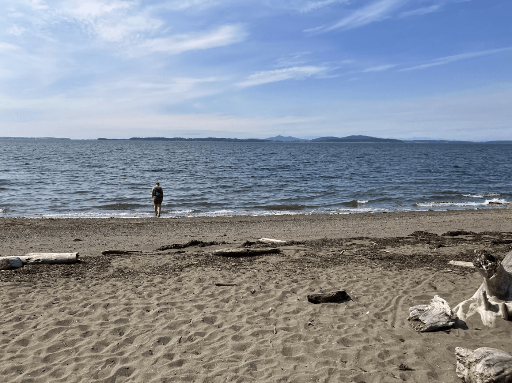
Several different people (and travel books) recommend Inverness as a home base, but not necessarily a city to spend much time in, but we really enjoyed it. The city boasts several walking areas and parks, and has a lot of natural beauty to offer. In addition to the Ness Islands, we also took the city bus to the northern edge of the city, along the Beauly Firth, the Merkinch Local Nature Reserve. Folks can often spot dolphins from this area (sadly, we did not) but the water stroll was really nice, with beautiful views of snow-capped Ben Wyvis in the distance.

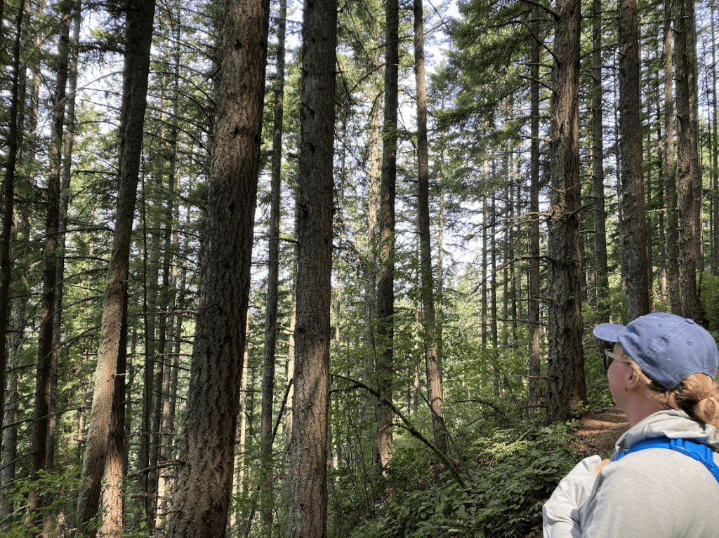
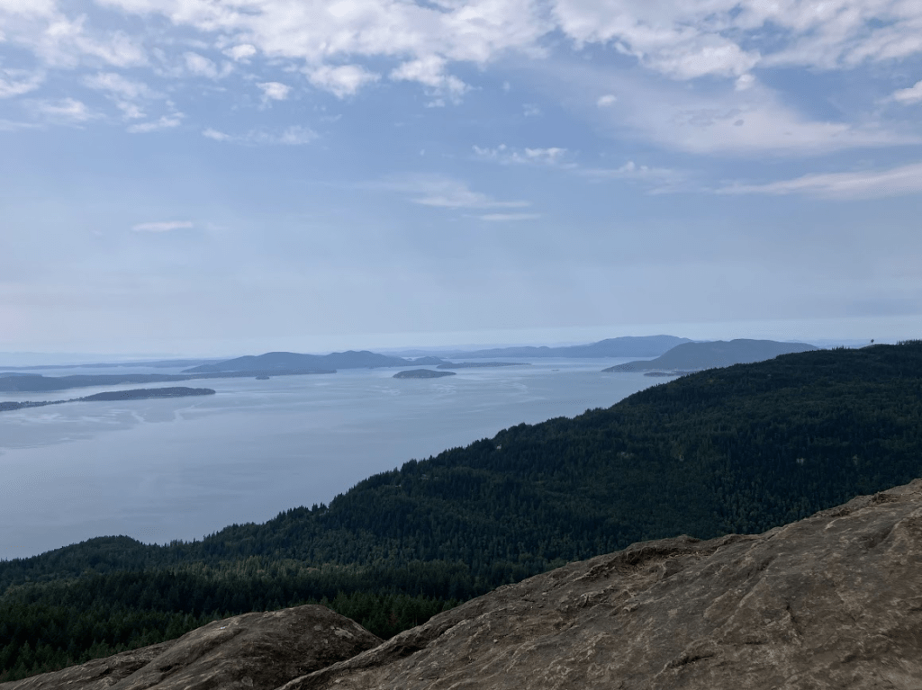
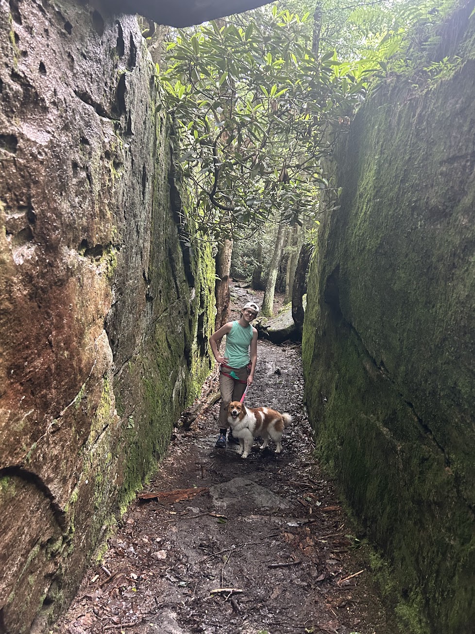
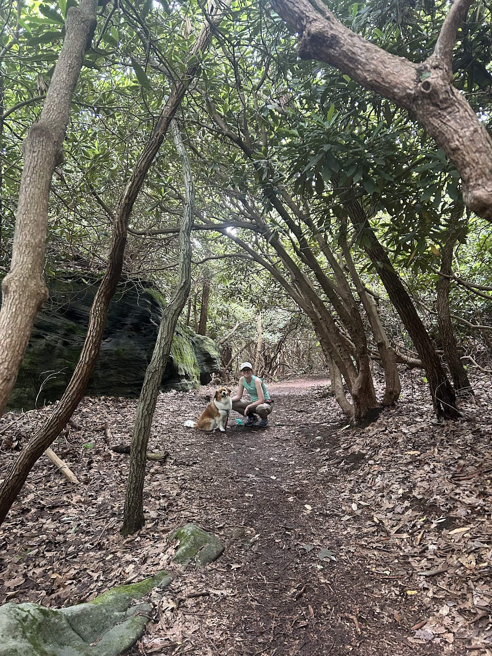
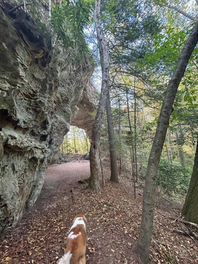
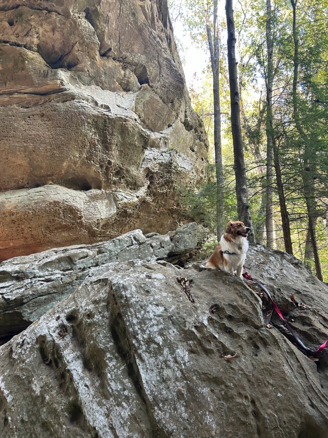
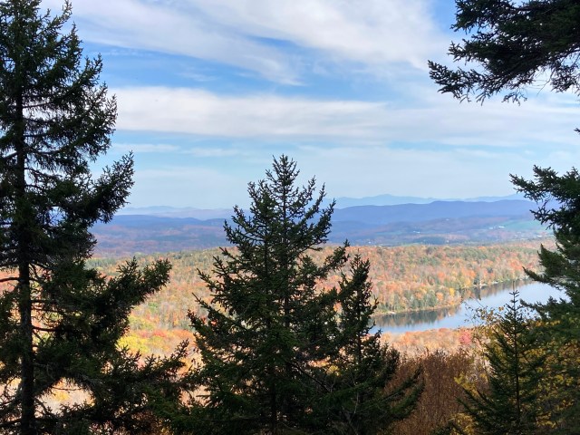
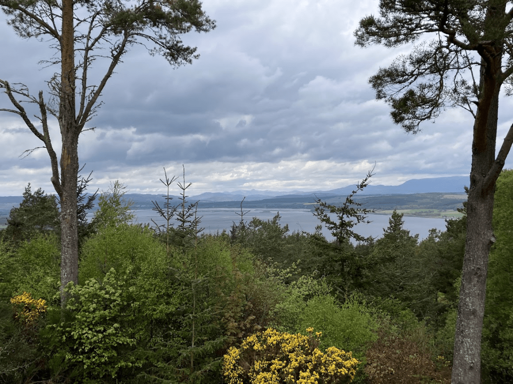
Once we rounded back on the path from the waterfront, we headed up the hill of Craig Phadrig. It was a steep but really lovely hike through a pine forest, with the occassional views of the firth, Ben Wyvis, and Inverness as we continued to climb. Lots of locals go here to walk their dogs. It is a bit confusing as there is no signage on the trails, but we managed to find the top with some advice from one of the local dog-moms.

At the top is the site of an ancient Pictish fort. Now, it’s just a field of grass at the peak, but not long ago, a large tree fell uprooting pieces of the land, revealing remains of a fort wall. Excavation in 1971 determined that: the fort was likely built around 500BC; the ramparts were thought to have stood eight meters tall. According to legend, this is were St. Columba came to meet Pictish King Brude with the mission of converting the Picts to Christianity.

For dinner, we went to the Mustard Seed, which came highly recommended and had won awards. It was mediocre at best, and I much enjoyed the other pubs and taverns we popped into throughout our stay:

  • Innis Bar – we came here for lunch for soup and shared a toastie. The service was friendly and food decent.
  • MacGregor’s – we didn’t eat here (just happened in prior to their kitchen opening), but we enjoyed a half pint and a dram
  • Glenalbyn – we popped into here for a quick pint before dinner. The mood was light with a decent beer selection
  • Urquhart’s Restaurant – came here for dinner for my last steak and ale pie – it was pretty tasty. We barely squeaked in, though; definitely a place where reservations are needed
  • Castle Tavern – probably gets touristy during more peak times, but it was a really nice spot for a pint and to relax for a while.

Things we didn’t get to:

When we initially had a car rental, we planned to do a hike in addition to exploring Loch Ness. Since we found such convenient (and CHEAP) public transit to Loch Ness, we opted out of the car. This was the right decision for Loch Ness, the bus was absolutely the right choice, but without a car, we were limited on our hiking options. Based on my research, particularly using Walk Highlands, I had identified two hikes:

Ben Wyvis, one of the largest Munros in proximity to Inverness. My thought here, concerning driving, was that it wouldn’t be too long or scary of a drive. The hike is long though, and challenging, but there is also Little Wyvis if its bigger sister’s 8 miles is too intense. Both have expansive highland views.

Thus, if I could do the trip again, I would have passed on the afternoon in Elgin and Forres, and instead taken the ember bus to Loch Ness on the day we arrived from Edinburgh. We got to Inverness around 1pm, which would have been sufficient time to explore the castle and enjoy the loch views. That would have left our next full day to pick up a rental car and pick one or two hikes that are inaccessible via public transit, like Ben Wyvis or Little Wyvis.

Alternatively, we could have remained scared of the rental car and taken the train back down to Aviemore (we had passed the town on the way north from Edinburgh). I think we hesitated on this due to Aviemore being such a tourist trap town, but there are several hikes accessible from the town center, like Craigellachie. It seems that most visitors probably go into Cairngorms National Park, so perhaps the more moderately challenging Craigellachie hike wouldn’t have been too busy, and boasts excellent views of the national park from the summit.

Lastly, you may be wondering — a trip to the highlands, but no Isle of Skye? We discussed it, but ultimately decided it we’d rather explore less crowded/touristy areas. It’s also such a hike out of the way, five hours from Edinburgh and three from Inverness. We looked into a bunch of tour companies, too, but they were all 10-12-hour marathons, quick tourist-grabs to take some selfies at all the top spots, but no time to actually explore. Next time, we’ll reserve a few days and actually commit to spending some time out there, rather than just a day trip.

_________________________________

Inverness Lez-Travel rating:

Inverness was an interesting place. I never felt unsafe, but there were some surprised looks upon folks realizing we were together. One bartender asked if we were sisters, and we responded that we were married, and he didn’t bother to try and suppress his shock at the news “Oooooooh. Oh. …Really!? Okay! Uh. Great!” (it was awkward).

Jesuit Pilgrimage and the Game of Thrones: Barcelona Day-Trips

Day Five: Montserrat 

There are tons of different ways to explore Montserrat, with dozens of tour companies taking advantage of tourists to offer big “excursions” for big money. I’m sure many of these are wonderful for those who want to do tapas, and wineries, and distilleries, and big coach buses, but for me and my wife, we just wanted to view the basilica – and hike.

Montserrat

If I could do it again, I would have started at the first transport up the mountain, as my only grievance was that we didn’t have enough time to explore all that we wanted to see. We did pieces of a few trails, but didn’t have the time for the longer hikes.

Getting there:

Because we wanted the maximum amount of free time to explore and hike around, we opted out of one of those company excursions with all-inclusive activities and instead purchased the “Trans Montserrat Ticket” from Turisme de Barcelona Information Office at Plaça de Catalunya. It’s not something you can buy online and just show on your phone; you have to go in person. You can buy them in advance if you know when you’re going; we simply purchased the day-of; however, if we had known for sure in advance which day we planned to travel to Montserrat, we would have purchased and picked up our card in advance to save some time day-of. There is also a “TOT Montserrat card” which includes everything we purchased, plus a buffet lunch.

The card includes:

  • round-trip train fare (you don’t have to pick the time in advance). The train is basically a commuter rail, not a high-speed train, so be prepared to make plenty of stops.
  • round-trip train or cable car to Montserrat. You must choose at the time of purchase between the rack railway car or the cable car*
  • unlimited rides on the funiculars. There are 2 funiculars, which grant you convenient access to the multiple levels of the mountain. We took the one to the very top to hike!
  • Access to the cathedral and audiovisual space.

*We did the cable car, and I’m glad we did – the views were incredible and it was honestly pretty awesome. Some things to note though: 1) for those claustrophobic, they really pack you in like sardines; 2) I would not recommend for folks scared of heights; 3) the journey is quick, but know that it’s standing room only for those with limited accessibility; and, 4) even in the off-season – early December – on a weekday, the line was long. We waited probably 15-20 minutes to board our car. There are only 2 cars that continuously loop, so were I to do this in peak season, I’d probably opt towards the rack rail to avoid waiting in a 45-minute+ line.

Day Six: Game of Thrones?

It happened again. Sickness strikes abroad.

We had another slow morning with a light breakfast and sudafed before taking the high-speed rail to Girona.

The train was about 40 minutes. We grabbed a snack of an incredible, loaded salmon toast from a bar on a square and then followed a guide through the old town. The bartender was very friendly and patient; she really appreciated our efforts to try speaking Spanish. The absolute coolest part was the city walls that originally enclosed the town (now, of course, the town spreads within and beyond the walls). The walls and towers are open access, and offer incredible views of the city. 

Several scenes from Game of Thrones were filmed here as well, and those interested can pay for Game of Thrones walking tours to show you all of the spots. We did our tour self-guided, but still made the effort to visit those locations from the show.

View if Girona, Spain from atop the town walls.

_______________________________________

Lez-Travel Rating:

This is a bit trickier to rate since we didn’t have much interaction with others. I’d be inclined to be distrustful of Montserrat, with it’s Catholic affiliation. Girona, a smaller town, seemed fine – while we didn’t notice any significance of gay pride showing, we felt safe.

Big South Fork & Charit Creek Lodge

I’ve written about Big South Fork in a previous post, so I won’t go into too much detail.

This year, we stayed for two nights in the Charit Creek Lodge. We rented the “Corn Crib,” the most loved space, judging by how hard it is to book (we booked nearly eight months in advance, a long weekend in November). Other spaces have screen porches and other outdoor seating, so I wasn’t as big of a fan as others in compared to the lodge rooms, but it was nice for the dog. The lodge rooms have an upstairs (separate access point, for staff), so our dog was very alarmed when strangers were walking around upstairs!

Our first night, we had only six other fellow guests, which offered a really nice, intimate setting. The second night, we were joined by a very large group of men – I believe a church group – and the dining hall was packed to the brim with maybe 30-40 guests; fortunately, the Charit Creek staff sat us with our friends from the previous night, two brothers who were also from Ohio.

As always, the food was absolutely incredible. Unlike last year, however, I felt that there never was quite enough food… at least, not for folks hiking six or more miles each day.

The trails:

Twin Arches Loop – I recommend going counterclockwise. You start with a nice relaxing stroll through the woods before reaching the steep incline. If you started early enough, you’ll get through the touristy section (people drive to just do the half-mile loop with the arches that’s adjacent to the parking lot) before it gets busy, then take the long, meandering, 2.5-3mi portion back down through the woods, with more unique arches and neat nature to view and take in.

Charit overlook – this is a horse trail, which is really nice because the trail is nice and wide, and not very technical (minimal roots and rocks in the path). It’s incredibly steep for the first half, but due to the width, you can walk several humans (and dogs) abreast and take your time with it. It follows a river before turning into a less steep woodsy trail before you get to the overlook at the end. You’ll see the horse parking and then the trail narrows to reach the lookout.

On our way out, we took the horse trail, which was… a mistake. We thought it’d be easier with our packs than the technical trail through the woods (which we loved on the way in), but the shorter exit resulted in a way steeper incline. Hard to believe a horse or carriage or even motor vehicle could climb that level of incline! Don’t do it!

Pacific Northwest

My brother-in-law lives in Washington state, about halfway between Seattle and Vancouver. What a bummer to have to fly out there to visit him.

It’s not even fair how gorgeous it is out there.

Our first full day, a Thursday, my wife and I started to explore while her brother and his girlfriend were at work. At their recommendation, we selected the trail called Oyster Dome, on Blanchard Mountain.

We drove up the first part of the mountain via a long, winding unpaved road. There’s a way to avoid this (adds significant elevation, with no facilities and minimal parking), but we simply navigated to the main parking area (Samish Overlook parking), which bypasses the initial ascent on foot, offering breathtaking views from the start (and toilets!). From the main parking area, it’s still about a 5-mile hike, which was sufficient for us for our first day anyway. The other trailhead is off Chuckanut Drive (must cross state highway to begin hike).

View of the Samish Bay, near the Samish Overlook parking area
View of the Samish Bay, near the Samish Overlook parking area.

We loved this hiking trail. The parking lot is quite large, signaling how busy the area can get, but we started mid-morning on a weekday and fortunately avoided crowds; we only crossed paths with a handful of people, and shared the summit with four others.

The trail begins steep, tackling a bit of the 1000-ft elevation gain, before leveling out through the cedar and fir forest. The trail crosses several creeks. Even while away from the views, the sounds and smells of the forests are incredible.

After enjoying the more level trail for a while, it spikes upward for a significant incline the final ~ half mile. As you continue up the switchback, the trail narrows as well, and becomes a bit more technical. Reaching the top is well worth it! You’re rewarded with a nice, wide rock face to sit and rest while enjoying the breathtaking views. The people of the pacific northwest are so friendly, too! When they discovered we were visiting from Ohio, they offered up other trails to check out, and their favorite meal spots nearby, as well.

We already had a plan for dinner that night, though, and after heading back down the mountain, we drove to downtown Mt. Vernon to meet our brother and his partner.

View from the top of Oyster Dome
View from the top of Oyster Dome.

Day 2

Another work day for our family, my wife and I drove to Larrabee State Park. Offering over a dozen trails to explore, we bopped around, quite sore from Oyster Dome. We drove first to the top of the park for the views, and then hiked a bit of the Ridge Trail before heading back down to the bottom of the mountain for the Clayton Beach trail.

View from Cyrus Gates Overlook

The Clayton Beach trail wound down the hill onto the beach. It’s a short trail overall; fairly steep, but a much more gradual slope than by the overlook. There are some rocky areas near the beach that we climbed up to relax and enjoy the views.

View of the beach in Larrabee State Park
Clayton Beach, Larrabee State Park

Once we wrapped up our time in the state park, we rewarded ourselves with a beer – we first tried “The Oyster Bar,” just off Chuckanut Drive, not realizing that it was fine dining (we were covered in sweat and sand and in our hiking gear, yikes!). We snuck away and instead headed to “Chuckanut Manor” — which sounds fancier but is less so. They had a good happy hour, and we ordered a couple of pints and a snack to share. The food was excellent and view from the patio beautiful.

Following our hike reward, we headed back to our family’s house for dinner. Our brother has gotten into duck hunting, and grilled some duck for us to try. My wife and I had stopped by the cheese store in downtown Mt. Vernon to complement our appetizers with some wine and cheese. Skagit Valley Larder was a great experience – we were able to sample the cheese prior to purchasing it, and they offered some recommendations that would pair well with the cheese (and the duck!)

Day Three

On Saturday, the four of us piled into the truck with the dogs and headed out to Ross Lake National Recreation Area. Just adjacent to North Cascades National Park, we were able to enjoy similarly amazing views … but also bring the dogs (no dogs in national parks, boo). We did the Thunder Knob trail, which was breathtaking but painfully crowded.

If I were to go again, I’d likely select a trail that’s typically less crowded.

On our final day, my wife and I went to Deception Pass before heading back to the Seattle Airport for our red-eye flight home. At Deception Pass, we hiked the Goose Rock Summit trail – which can be either a shorter, steeper out-and-back, or a full loop trail. We did the latter, hiking the steep climb on the way up to grant us the slowly meandering path back down to the parking area.

___________________________________

PNW Lez-Travel rating:

The Pacific Northwest is an interesting place when it comes to gay travel. There are lesbians everywhere… but you’re in such a rural area, that you meet some closeminded idiots, as well, and certainly see a lot of Trump flags. Based on our experience, these are not the same folks we encounter on the trails or town centers. PNW wins 3 rainbows.

Coopers Rock State Forest, WV

Long overdue for our first camping trip of the season, we hit the road, heading west to a new state park in West Virginia (new to us, I mean!). My wife grew up camping in the Upper Peninsula, and I grew up camping in the higher altitudes of the Smoky Mountains, so camping in extreme heat is a no-go for both of us. Although June is typically mild in Ohio, this weekend was predicted to break into the mid-90s, so I researched as many parks and campgrounds that I could find in the mountains, landing at last on Coopers Rock. It’s about as high of elevation as I could find in under 4 hours from Columbus, but it was just enough to to drop the temperature about 10 degrees.

The campground has two camping circles – one fixed with electric and water for RV camping, and a second circle for tents only. The tent area is smaller, but the spots are spacious, shaded and semi-private. My first complaint is that most of the firepits are right along the road. Due to the campground being a small circle, we didn’t have to deal with much motor traffic, but it did feel less cozy to not be nestled under the trees of the campsite.

The tent loop circles a single bathhouse, with trails through the woods to reach it. They had running water and real flush toilets, not too rustic for camping-newbies, but a bit of a hike to the toilets for those who want closer proximity.

My second complaint was that the camp store closes at 6pm, which is right around the time we pulled in. They allow after-hours self check-in, but the closed camp store meant no firewood for us during our first night. This was a bummer, but the scattered showers led my wife and I to grab some illegal beers (no alcohol at the campground, whoops, didn’t realize that at first) and lounge in our tailgating tent to chat and stay dry.

I have aired my grievances – now, to the good stuff. Because the campground consists of a single loop, the campsites on the outside lead right into the forest. This offers a more private experience, but also allowed us to see some wildlife! When we first pulled in, two deer were chilling at our campsite, and we saw nearly a dozen more throughout the weekend. We also saw a deer feeding its fawn!

The hiking was the best part. Near the camp store (the “trading post”) is a brief, accessible trail to a large and gorgeous overlook. You can also hike the “underlook,” which is a trail going below the lookout. It’s very short, but steep with some scrambling bits at the end. I would highly recommend this trail to see more of the forest and to feel like you’ve really earned your reward (the view!).

Another trail to an overlook is Raven’s Rock. The trailhead is a bit confusing; on the first day, after parking, we began hiking the trail by the sign board and maps, but after a while all the blazes disappeared. There are still trails to explore, but not the main hike to Raven’s Rock. We passed a couple other confused hikers, so we know it wasn’t entirely user error!

The next day, we did find the correct trailhead, just a bit further down the road, towards the park’s cabins. The area had gotten a significant amount of rain in the week leading up to our trip, so to say we hiked through a creek would have been more accurate than on a trail. We definitely saw more hikers on this trail than any other, but it was still calm without a ton of traffic, which was nice. The trail (river, in our case) crawls steadily downhill for the first mile before reaching a steep incline at the end towards the lookout. The view was worth it!

Overall, perhaps my favorite part of this area was the proximity of all of the trails. While there is parking at all of the trailheads, you can walk to most of them from your campsite, limiting the need for your car while camping. We did this to reach my favorite hike, the Rock City trail.

Rock city started with a nice, gradual incline through the forest. After about a half mile, you reach a fork in the road and a picnic shelter. You can do a sharp left to take the Rattlesnake trail, or continue on past the shelter for Rock City. We had actually planned on the more moderate hike of the rattlesnake trail (hopefully free of any poisonous snakes), but upon witnessing what the rock city trail looked like, we continued that way. The trail passes through rock walls on either side, with rhododendrons creating a gorgeous canopy above you.

On our way back, it began pouring, and so we picked up our pace and took shelter in the covered picnic area, JUST in time. When the rain lightened up, we hit the trail again, back “home” to our campsite.

Back at our site, the rain continued to roll through. It’d pour for a few minutes, then the sun would come out, then out of nowhere, it poured again. Our ability to cook dinner was beginning to look a little bleak, so we hopped into the car, drove down the mountain, and went to a lakeside restaurant. We felt a bit like we were cheating, but the draft beer was fresh, the food was good, and the post-rainstorm lake breeze was lovely.

The rain continued off and on for the rest of the night, but we fortunately were able to get our fire hot enough to keep rebuilding it after each shower. Overall, we had an amazing time at Coopers Rock, and would definitely return to this campsite again in the future.

Big South Fork Nat’l Rec Area

As a kid, I’d go camping most years at Big South Fork, a national recreational area in Tennessee. Within the park, accessible only by foot (or horse), is Charit Creek Lodge. They provide the room, bed (and bedding!), breakfast and dinner. The meals are served family-style, offering the chance to meet people from all over the country. At our table, there were several Tennesseans, but also folks from South Carolina, New York, and Michigan.

The main lodge with the dining hall has two private cabin rooms on either side, with a shared back porch. I will admit that I initially balked at the price of one night stay for two humans and one dog, but when I realized that the food is, like, absolutely delicious, and far exceeded my expectations (I was picturing basic “camp food”), the cost seemed to be much more reasonable. And if you’re staying multiple nights, you also get a sack lunch! Our dinner consisted of meatloaf, a cheesy pasta dish with baked beans, vegetable casserole, and a fresh salad with nuts and goat cheese. Our breakfast was a delicious crustless quiche, sausage, and nut muffins.

Upon arriving, the first trail we tried was the Slave Falls Trail, but, just as Ohio is experiencing with this long drought, the waterfall was, well, nonexistent, and the creek a mere trickle. The woodsy stroll was lovely though, although we were a bit alarmed early-on in the hike at our first bear sighting! We’d slow down and make noise at every sharp turn to not catch a bear by surprise.

From there, we drove from the Slave Falls trailhead to the Twin Arches trailhead to eat a picnic lunch. We then hoisted on our packs, hoping to not fall off an arch with the weight of our overnight stay on our back.

The arches were incredible! Of course, the pictures don’t do it justice, but it was wild that, growing up in Tennessee, I never hiked that trail to see them. 

The rest of the trail was steep down into the valley where the Lodge sits, but a nice, enjoyable and woodsy path. Most tourists hike the small, 1-mi arches loop (the larger loop is over four miles), and so we only passed two other people as we hiked about 2 mi of the full loop to arrive at the Lodge.

After checking in, we dropped off our belongings in our massive room with one queen bed and four single bunks. They provide lanterns, as well as a cooler to put in any food or other yummy-smelling thing to the bear neighbors. We went to shower next – it is a shared facility for all Lodge guests, but the individual stalls were large, spacious, the room was warm, and the water was hot – definitely the best “camp” shower experience I have had. Note: towels not provided!

I’ve already shared what they served for dinner (while drooling just thinking about it). They also offer beer and wine for purchase, so my wife and I tied up the dog with a bone and sat in large rocking chairs with our beers, enjoying the gorgeous Tennessee fall weather.

In the morning, full up on quiche and sack lunch stored in our cabin cooler, we hiked up the Charit Overlook Trail. It’s a very wide horse trail, and though steep, it wasn’t rocky. All three of us could walk side by side. It was a hike I wish we had taken more time with, because the views from the top were lovely, but we hastened back down the mountain to check out by 11. 

We packed up and gathered our belongings from the cabin and returned to the rocking chairs to eat our sack lunch.

On our way out, we did the western part of the Twin Arches Loop, about 2.5mi. It climbed out of the valley much more gradually than the eastern part of the loop, and once we were up on the ridge, the views, rock formations, and parts of the arches all were incredible to enjoy.

To make the most of our second day in the park, we booked a hotel in Richmond, KY, to avoid driving the 4.5 hours home in one go. We drove the two hours to our hotel, picked up a pizza. We were way too pooped to enjoy the stop and went right to the hotel, but we’ve been to Richmond before; it’s a cool college with great BBQ and beer. Dogs were allowed at Dreaming Creek Brewery, and they typically have a food truck on site as well. Smitty’s BBQ was fast-food meets cafeteria-style restaurant barbecue (reminds me of Buddys BBQ back home in Knoxville); we got tons of food for so cheap, and all of the everything was tasty.

Pickerington Ponds & Walnut Woods

Pickerington Ponds

After two days of hunkering down from the hurricane (who knew those could be such a big threat in landlocked Ohio!), the dog and I were going stir-crazy. The winds had died down but the rain continued steadily; despite the weather, I hit the road and headed to Pickerington Ponds metro park. 

My dog, who usually has no problem with rain or being wet, kept giving me this look as if to say, “really? a two-mile hike in this?”

I started on the Blacklick Trail – the 20-mile paved bike path – to reach the trailhead of the Burning Lake loop, the only dog-friendly hike at Pickerington Ponds. Similar to other dog-friendly paths at the Columbus metro parks, it’s a big loop through grassy meadows, with a very small woodsy stretch at the southern part of the loop.

On the way back, I noticed a trail connector to the Arrowhead Trail, a slightly shorter walk back to the parking lot and way to bypass the paved portion of the bike path. Ignoring the “no pets” sign (honestly, it was pouring, and I was the only one desperate enough to be walking in those conditions!). We enjoyed the Arrowhead much more; a wide path through the woods, it shielded us from the worst of the rainfall and had a much more quiet, peaceful vibe (and better sniffs for the dog).

Overall, not a great option for dog-parents, what with only one trail to use (assuming you want to follow the rules, don’t take my example). Additionally, as it was pouring, I did not take any pictures!

Okay, so… I also confess to breaking the rules at Three Creeks Metro Park. Our favorite spot for biking, we’ve also brought the dog for a walk along the paved trail. I was surprised to see that, even after the hurricane, the pond is still dried up from our summer (and now autumn) drought.

When I reached the Confluence Trail, a narrow path through the woods and along the creek, marked clearly with a “no pets” sign, I decided to give it a whirl. We had never explored this path as we always have either our bikes or the dog. I was hesitant to break the rules, but I didn’t pass a single person for the mile hike, and really enjoyed being in the woods. Note: this area was heavily infested with ticks.

Walnut Woods

Now to one of my favorites: Walnut Woods Metro Park. Every single trail is dog-friendly, and most trails are paved, as well, for those preferring a more accessible stroll. The best is the “Tall Pines” area of the park – specifically, the Sweetgum Trail. It’s a 2.6mi figure-8 loop trail, with an additional unpaved cut-through to one of the largest trees I’ve ever seen in Ohio. This half-mile option is lovely: typically quieter and less trafficked, you certainly feel more in the woods. And the smell of that pine? It makes me think of the smell of home every time.

We love the Sweetgum Trail so much, we haven’t even explored some of the other trails at the park, but we’ll report back once we have Tonks’ stamp of approval.

Vermont

For our third anniversary, we wanted to get out of the city: enjoy nature and explore an area with minimal covid-risk, which brought us to the beautiful outdoors of Vermont. We found a lovely airbnb in the town of Ryegate, near the border of New Hampshire.

As a New Englander at the time, all the fuss for nature and mountains is focused on New Hampshire. Let me be clear: Vermont is far superior to New Hampshire. As John Oliver once said, “New Hampshire is just Florida with foliage.”

Vermont is just as beautiful, and though it boasts lower peaks than New Hampshire’s white mountains, you get to avoid the traffic, tourist crowds, and focus on enjoying nature.

In mid-October, it was peak autumn colors. Near Ryegate was a cluster of state parks that we explored, all around the Groton State Forest: Kettle Pond, Big Deer, New Discovery, Ricker Pond, and more. An old rail-trail (Cross Vermont Rail Trail) links many of those state parks. The packed-dirt path leads through the woods with great views of the foliage and the water. We had our dog with us on the trip, so we didn’t bike for long, but I would definitely return and do more of this 30-mile bike path.

We hit up many hiking trails nearby, but our two favorites were Owlshead Mountain Trail (park at New Discovery State Park, pay to enter) and Devil’s Hill.

Owlshead Mountain Trail was a moderate out-and-back trail, up to the 1800ft peak with incredible views. Devil’s Hill, however, was our favorite; lightly trafficked, and free parking at the trailhead. Devil’s Hill is a partial loop, so the dog got fresh sniffs and our legs got a bit of a break with the more roundabout, less steep descent.

And though I harp on Vermont being better than New Hampshire, we did swing through the White Mountains on the drive back to Rhode Island – stopping for a couple of hikes at Franconia Notch State Park. And I stand by my judgment: it was packed. We did the Artist’s Bluff Trail, and though beautiful, it was crowded, and at certain points, we had to wait a while for others to pass before we could continue the climb. We also did Bald Mountain, a short out and back hike that was slightly less crowded and had incredible views as well. But overall, my main memory is how the parking lots were mostly full, the portable toilets were overflowing, and all this on a random Wednesday in October… what is it like on a Saturday?! Listen. Just go to Vermont. If I could do it all again… I’d have spent our last day in Vermont, too. Though we had two full days of hiking in Vermont before heading out, it wasn’t enough!

It’s hard to comment on a Lez-Travel rating on this trip. Because we traveled from our airbnb and only did hikes, even cooking and eating at our Airbnb, we didn’t really explore the surrounding towns or go out much. It was a rural part of Vermont, and the interactions we had with other hikers were friendly, but minimal.